Territories
Territories define responsibility across geography.
While pins represent individual locations, territories define the area within which those locations are managed. They provide a structured way to divide a map into meaningful zones. Over time, they become the framework for accountability, coverage and performance.
Territories are available on Team plans.
What a territory is
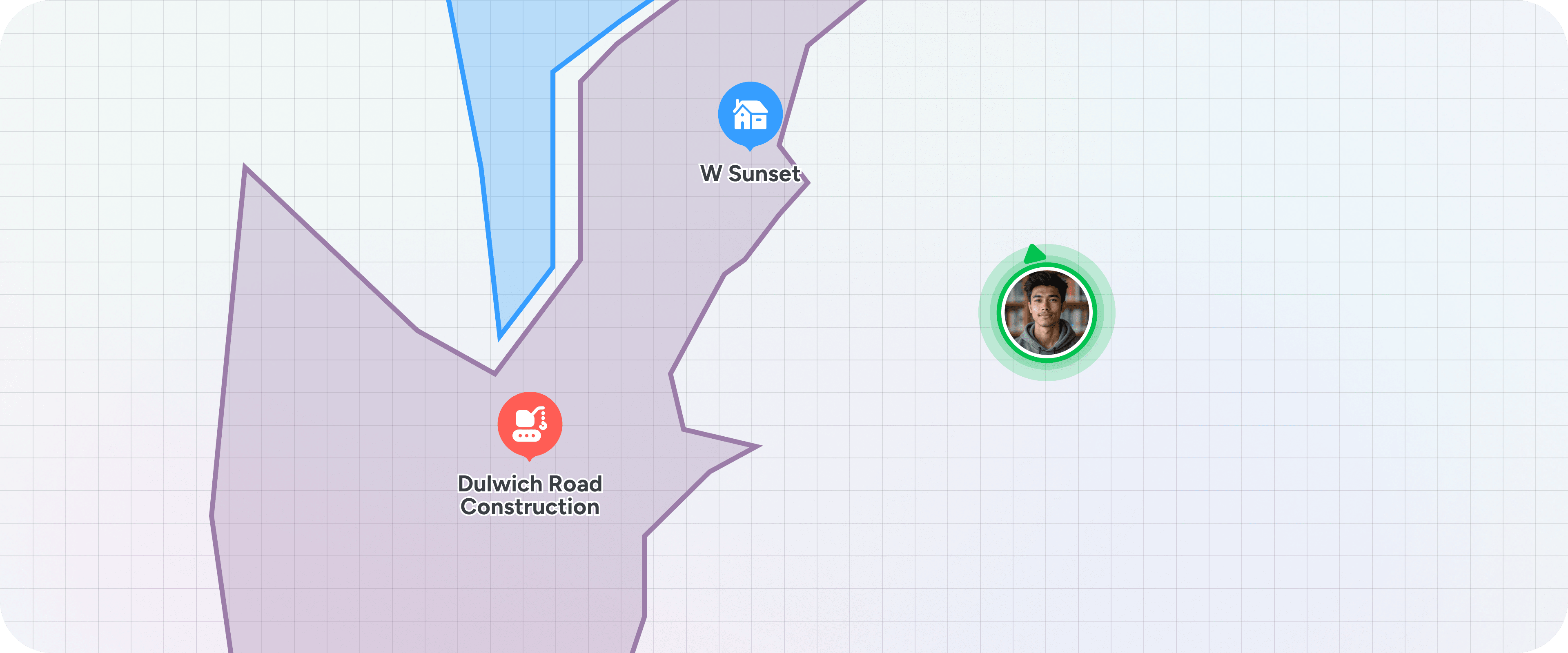
A territory is a drawn polygon on the map. It is created by marking boundary points directly onto the map, forming a defined area.
Once created, the territory becomes a living container. Any pin that sits within that boundary is considered part of the territory. If territories overlap, a pin can belong to more than one territory. If a pin exists outside all defined boundaries, it simply exists independently.
Pins added outside a territory do not change its shape. The boundary is intentional and must be edited directly if adjustments are required.
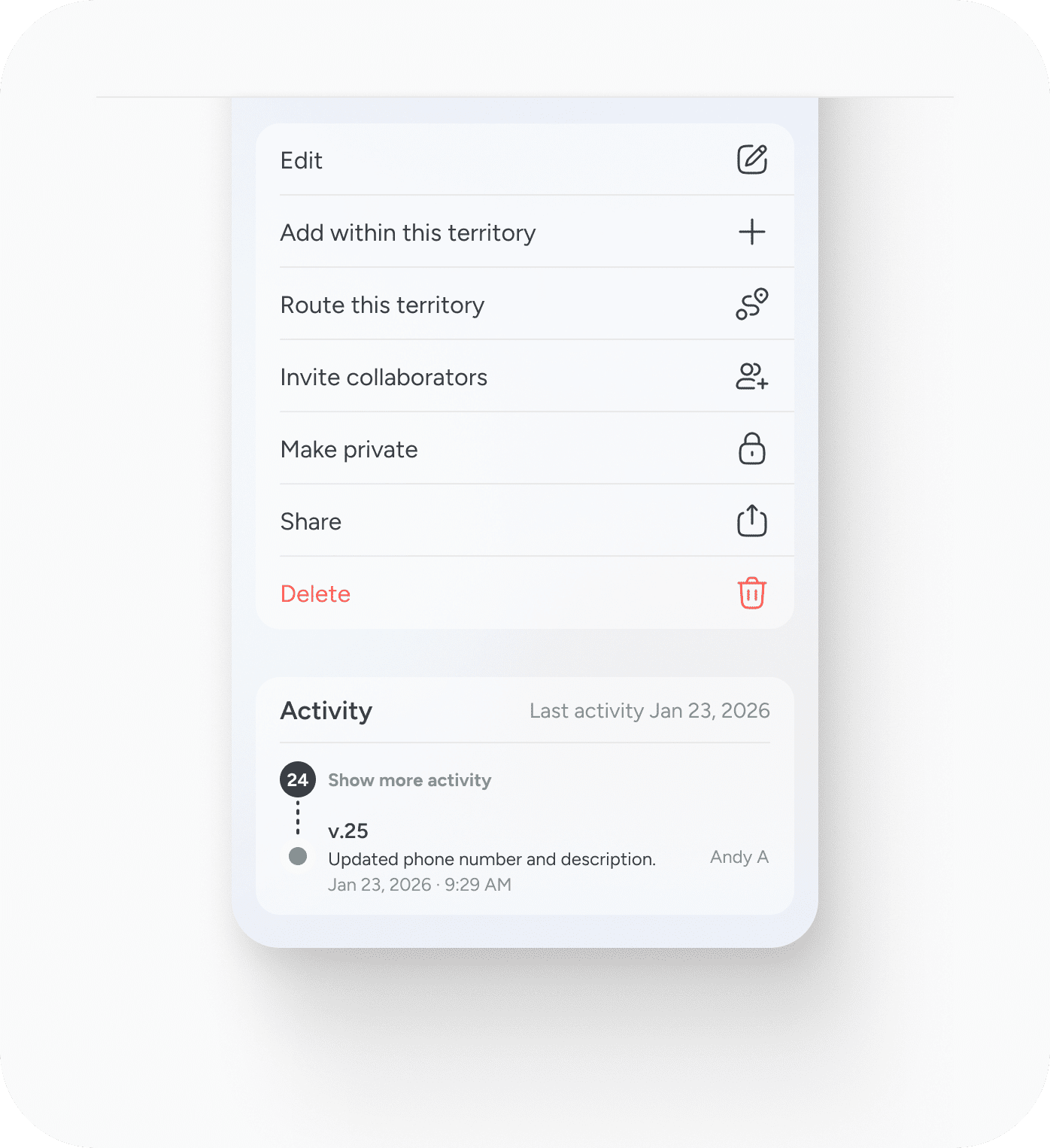
Territories can be renamed, reshaped and reassigned at any time.
Why territories exist
As the number of locations grows, clarity becomes harder.
Without boundaries, it becomes difficult to answer simple questions:
- Who owns this area?
- Are we covering this region properly?
- Where are gaps forming?
- Where is activity concentrated?
Territories provide that structure. They allow teams to divide geography in a way that aligns with how they actually operate.
- For sales teams, that might mean revenue responsibility.
- For service teams, coverage areas.
- For environmental consultants, survey zones.
- For facilities teams, asset regions.
The concept remains the same. Geography becomes measurable.
Ownership and collaboration
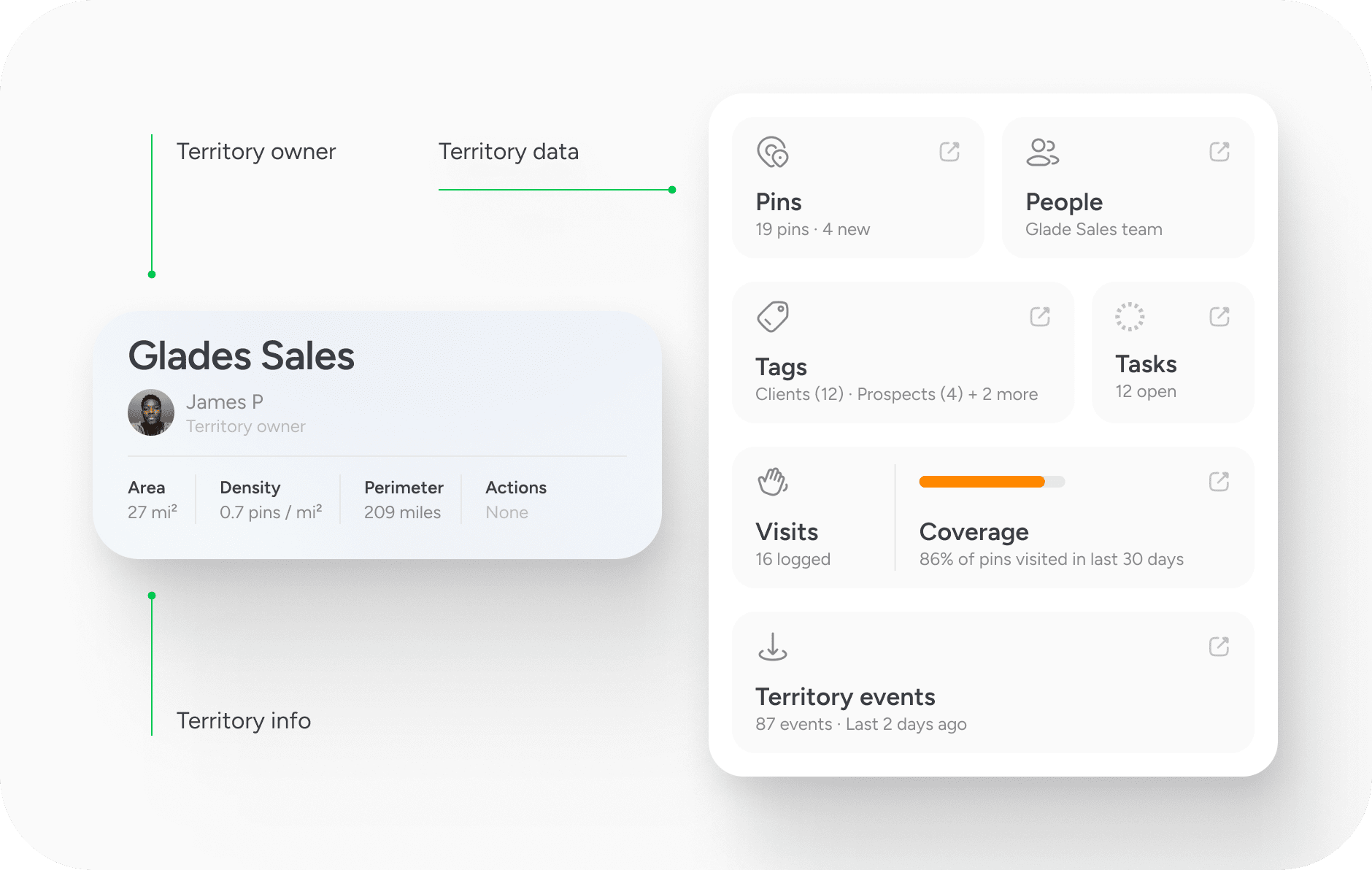
Each territory can have one or more owners. Ownership defines responsibility for what happens within that area.
On Team plans, territories are collaborative. Team members can view territory information, including pins, tasks, visits and related activity. Advanced reporting and analysis are available on Team+ and Team Pro plans.
Because territories are tied to geography, visibility is shared. There is no hidden layer inside a team workspace.
What you can do within a territory
A territory is not just a boundary. It becomes a working view.
From within a territory, you can:
- Route between locations inside it
- Filter and search using territory boundaries
- Analyse activity within its area
- Review visit history and coverage
- See associated tasks and tags
Coverage metrics provide insight into how many pins have been visited over a defined time period. Density shows how concentrated locations are within the area. These metrics turn geography into insight rather than assumption.
Overlapping territories
Territories can overlap. If two boundaries intersect, pins within the shared area will belong to both territories. This allows layered responsibility structures.
For example, a regional boundary might overlap with a vertical market boundary. One defines geography. The other defines client type. A single location can logically belong to both.
Overlap does not merge territories. Each remains distinct, but the shared geography is recognised.
Importing territory data
If you already have defined territory boundaries in another system, these can be imported with assistance. Direct self-serve import is not currently available, but we can help structure existing data into usable territory boundaries.
This ensures continuity if you are transitioning from another platform.
Editing and lifecycle
Territories are flexible. You can adjust the shape as regions change, rename them as structure evolves and reassign ownership as teams grow. Boundaries are not permanent, but they are intentional.
Deleting a territory removes the boundary but does not delete the pins within it. Locations remain intact. Only the geographic grouping is removed.
A simple principle
Pins tell you what exists. Territories tell you who is responsible for where. When boundaries are defined, coverage becomes visible. Activity becomes attributable. Performance becomes measurable.
Territories turn a map into an operating structure.


