Pin Drop vs Esri ArcGIS

Advanced spatial analysis vs operational clarity
ArcGIS models geography. Pin Drop structures field operations.

Layered GIS data vs site-based history
GIS platforms analyse terrain and assets. Pin Drop builds activity at each location.

Enterprise deployment vs lightweight adoption
ArcGIS requires structured implementation. Pin Drop is ready for field teams immediately.

Mapping infrastructure vs territory ownership
GIS supports spatial intelligence. Pin Drop defines responsibility across regions.
When GIS is more powerful than the operational need
Esri ArcGIS is one of the world’s leading geographic information systems. It supports advanced spatial analysis, infrastructure modelling, asset management and enterprise-level GIS deployments across government, utilities, transportation and environmental sectors.
For organisations requiring layered geospatial data, predictive modelling or complex mapping infrastructure, ArcGIS provides powerful tools.
However, many operational teams do not require advanced GIS capabilities. Their need is not spatial modelling. It is clarity across physical locations where work occurs.
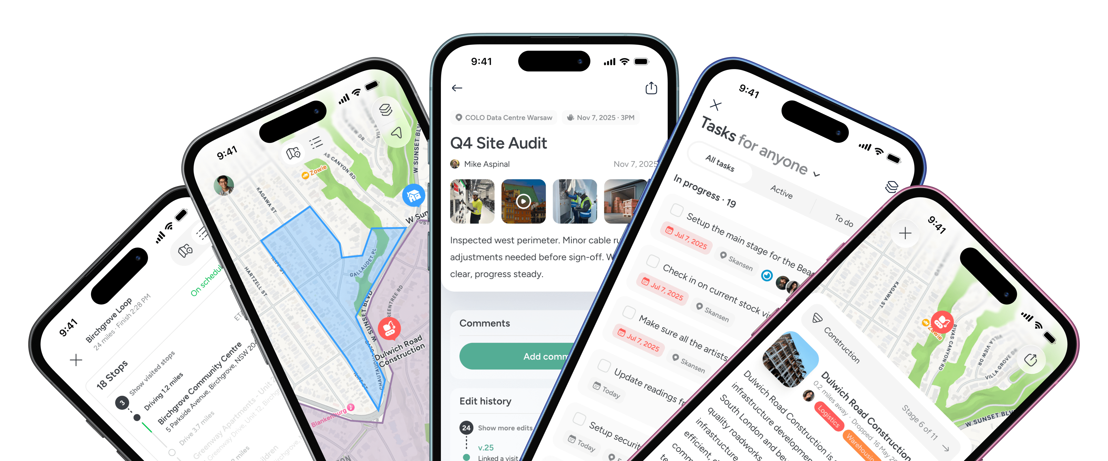
Field teams managing territories, inspections, site visits or distributed infrastructure often require structured operational visibility rather than geospatial analysis. They need to see who owns which region, what has happened at each site and how activity accumulates over time.
In enterprise GIS systems, operational activity can become one layer among many. In operational reality, location is the anchor for accountability and coordination.
Pin Drop centres every workflow around the physical site itself. Tasks, visits, projects and notes attach directly to that location. Territories are drawn and assigned. Multi-site oversight becomes intuitive rather than technical.
Many organisations continue to use ArcGIS for spatial intelligence while adopting Pin Drop to structure day-to-day field operations. One supports geographic analysis. The other supports operational clarity.
The difference lies in architectural intent: geospatial infrastructure versus place-based operational management.
Capability
Pin Drop
Esri (ArcGIS)
Two different layers of geographic capability


Field structure without enterprise complexity


A closer look at how teams work together with Pin Drop
FAQs


