Agri-tech & Agronomy
The shared map UK agronomists run their crop walks from
Independent agronomists, agronomy partnerships and agri-tech research teams use Pin Drop to lay out trials, walk crops on the parcel they were drilled in and keep BASIS-recorded recommendations tied to the boundary they were written for.


BEST OF 2013
Rated 4.7/5


FEATURED APP

Trials that live on the tramline, not in a notebook
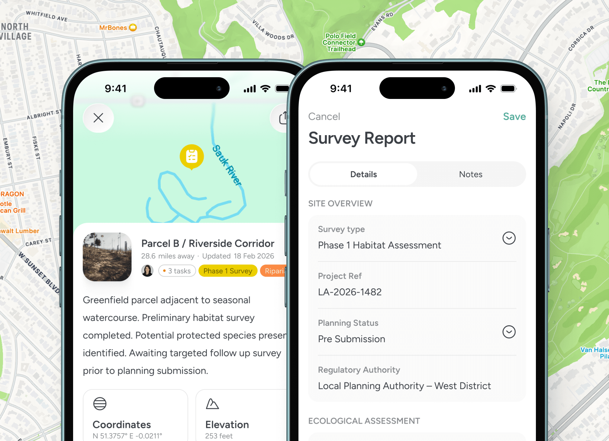
A variety trial across 18 sites in Lincolnshire and East Yorkshire produces useful data only if every plot is geographically pinned, the drilling date and the seed source are attached and the in-season scouting drops to the same plot. Pin Drop holds the trial layout as polygons and the assessments as pins inside them.

Crop walks that stay tied to the field
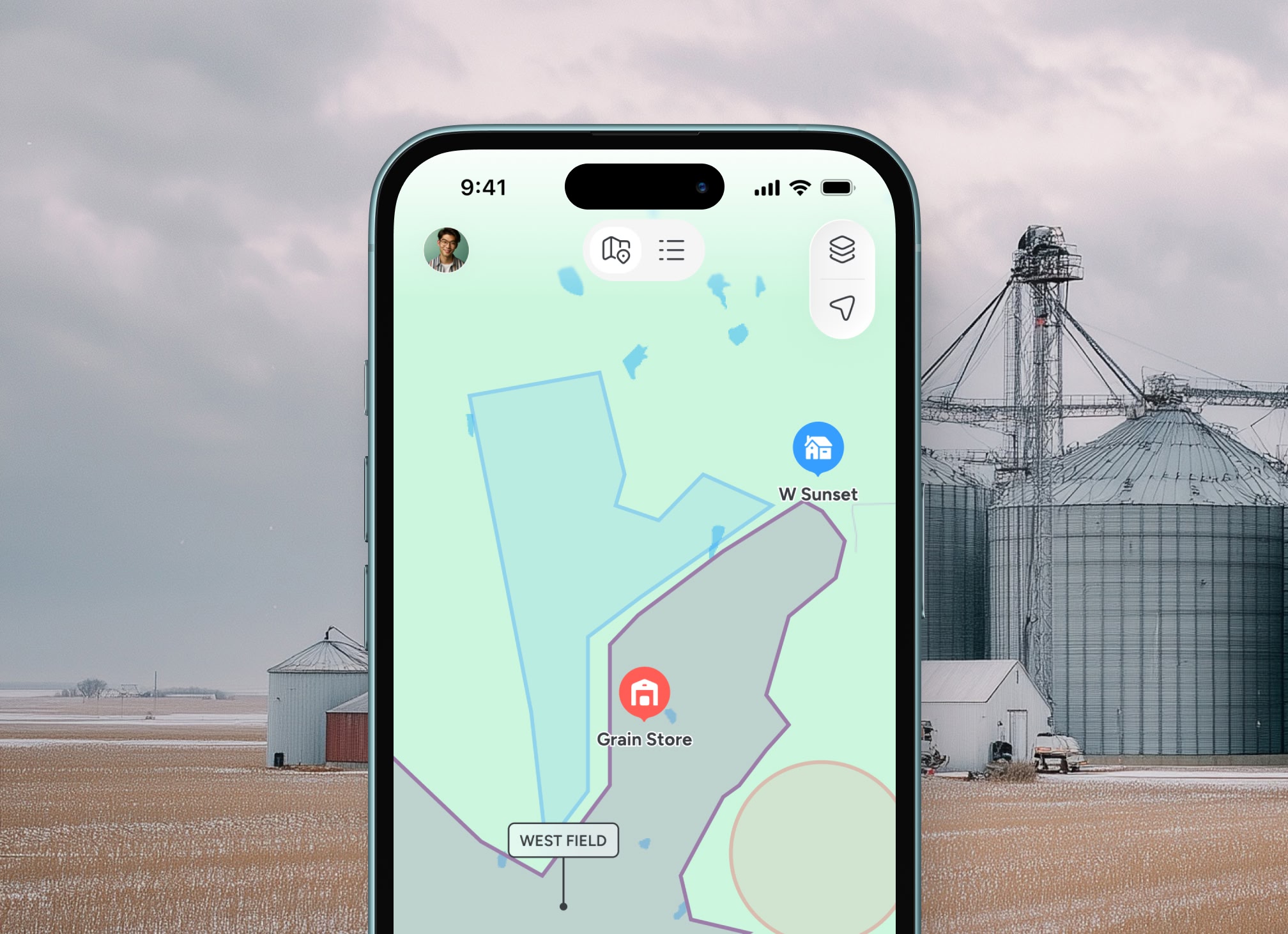
An agronomist scouts a 60-hectare crop of winter wheat for septoria, yellow rust and aphid pressure. Each finding pins to the spot, with photos, the crop stage and a tag for the disease or pest. The recommendation drops on the same parcel and reaches the farm office in one tap.

Visit routes that match the season
Late September means oilseed rape germination checks. Late April means T1 timing on wheat. Pin Drop sequences the round so an agronomist working a patch from Newark to Skegness sees the most timing-sensitive crops first, with directions, gate codes and the latest grower note loaded before the van moves off.

Records that hold up to BASIS audit
Recommendations made under BASIS-recorded standards, with product, dose and target, attach to the parcel they were written for. The audit trail is the map, the photos and the time-stamped pin. Rated 4.7 out of 5 from over 1,400 reviews.
September to March, on the tramlines
Built for the rhythm of UK agronomy

From drilling-stage assessment to harvest follow-up
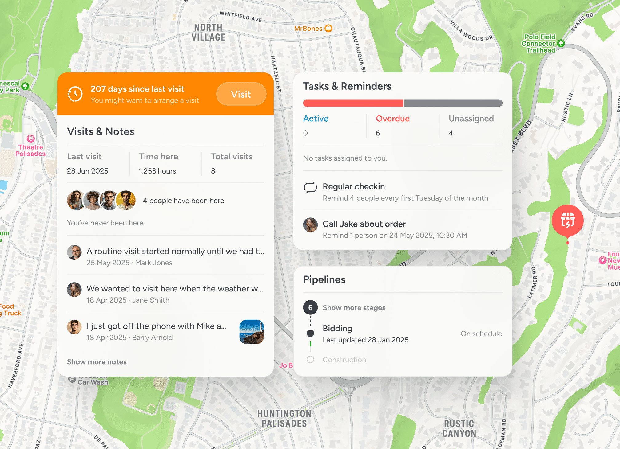
An agronomy year has a shape that nothing in a generic CRM understands. The autumn plant-counts on early-drilled wheat. The November residual herbicide checks. The February nitrogen plan once the season's index has settled. The mid-March T0 fungicide window if Septoria pressure is showing. The May flag-leaf scouting for ear diseases. The June grain-fill walk. Pin Drop holds the year as a sequence of visit types, each one anchored to the parcels that need it. The agronomist working a 7,500-hectare client list across two counties opens the map at the start of the week, sees the parcels due a T0, the parcels due a residual top-up and the variety trial sites due an emergence count, and sequences the days against the weather window. Recommendations sent to the grower drop straight to the farm's view of the same map. Pin Drop is rated 4.7 out of 5 from over 1,400 reviews.

Testimonials
Trusted by UK agronomists, advisers and agri-tech teams
Used by independent agronomists, agronomy partnerships, breeding companies running variety trials and agri-tech research groups. Rated 4.7 out of 5 from over 1,400 reviews.


“Mapping our trial fields has made it much easier to track observations throughout the season.”

Emma Richardson
Senior Agronomist
“Logging inspections directly against each field keeps our records organised.”
Daniel Knight
Crop Consultant
“We finally have visibility across our trial sites without relying on separate spreadsheets.”
Lucas March
Field Research Manager
Guided walkthrough
See agronomy work on a shared map
Walk through how an agronomist plans the week from the map, scouts a winter wheat field and sends a BASIS-recorded recommendation back to the grower without leaving the workspace.


