Environmental Planning & Assessment
Turn environmental fieldwork into structured evidence
Map survey sites, track environmental assessments and manage project territories in one operational system designed for planning consultants and field teams.


BEST OF 2013
Rated 4.7/5


FEATURED APP

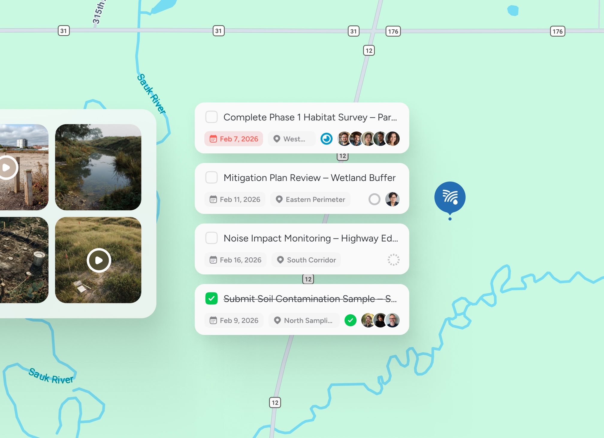
Map every survey site
Assessment locations, protected habitats and development zones sit in one operational map. No fragmented site lists or disconnected registers.

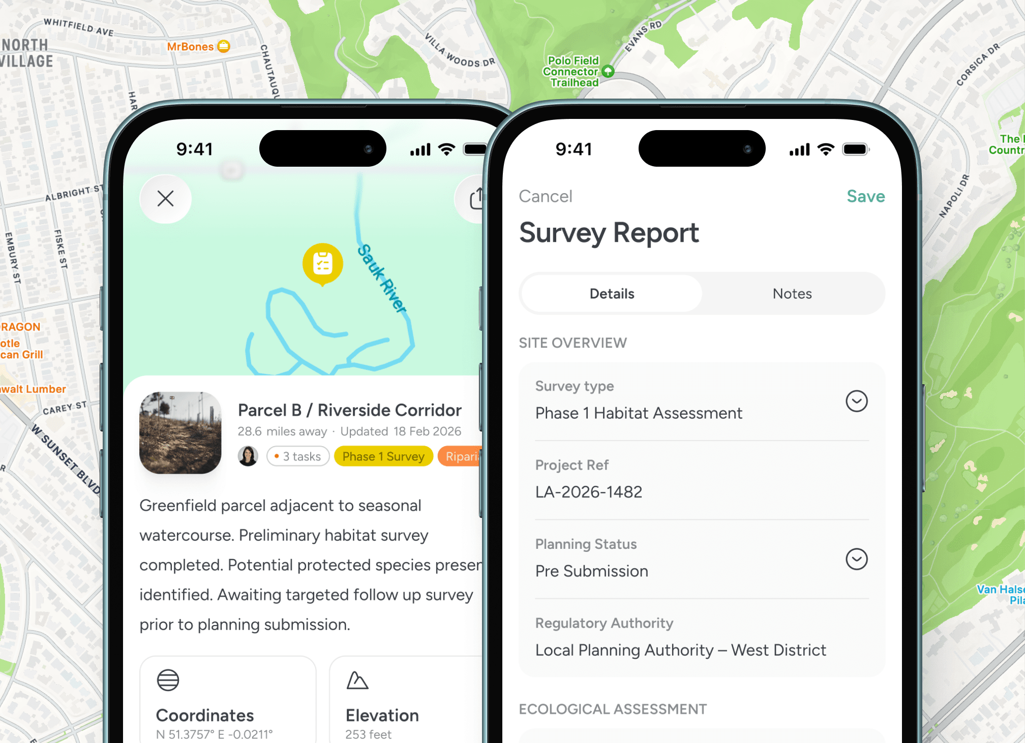
Capture findings in context
Observations, imagery and notes are logged directly against each mapped location. Evidence remains tied to geography.

Define project boundaries precisely
Planning zones and responsibility areas are structured and assigned. Overlap reduces and accountability strengthens.

Track impact activity over time
Historic surveys and follow up visits remain linked to location, supporting long term environmental oversight.
Built for environmental fieldwork
Location becomes the organising principle

Structured data across projects and territories
Environmental planning requires repeat site visits, regulatory scrutiny and defensible documentation. Every survey point becomes a structured record. Every update is tied to place. Every project remains measurable across time.


Testimonials
Trusted by environmental planning professionals
Teams responsible for surveys, impact assessments and regulatory submissions.


“Notes, locations and progress stay together, which makes reporting much more reliable later on.”

Priya
Environmental Survey Lead
“Field evidence tied to location improves both accuracy and confidence during regulatory review.”
Isabelle Martin
Environmental Compliance Lead
“Project zones and site history are structured geographically. Oversight is far easier across complex developments.”
Daniel Okoye
Planning Project Manager
Guided walkthrough
Structure your environmental projects around place
If your team manages survey sites, planning zones or environmental assessments across territories, explore how a structured operational system can support defensible reporting and coordinated fieldwork.


