Environmental Monitoring & Conservation
The shared map UK ecologists and conservation teams survey from
Ecologists, conservation officers and environmental consultants use Pin Drop to plot survey points, draw habitat parcels and capture species observations against the polygon they were recorded in, on or off-grid.


BEST OF 2013
Rated 4.7/5


FEATURED APP

Survey points, habitats and licensed sites in one canvas
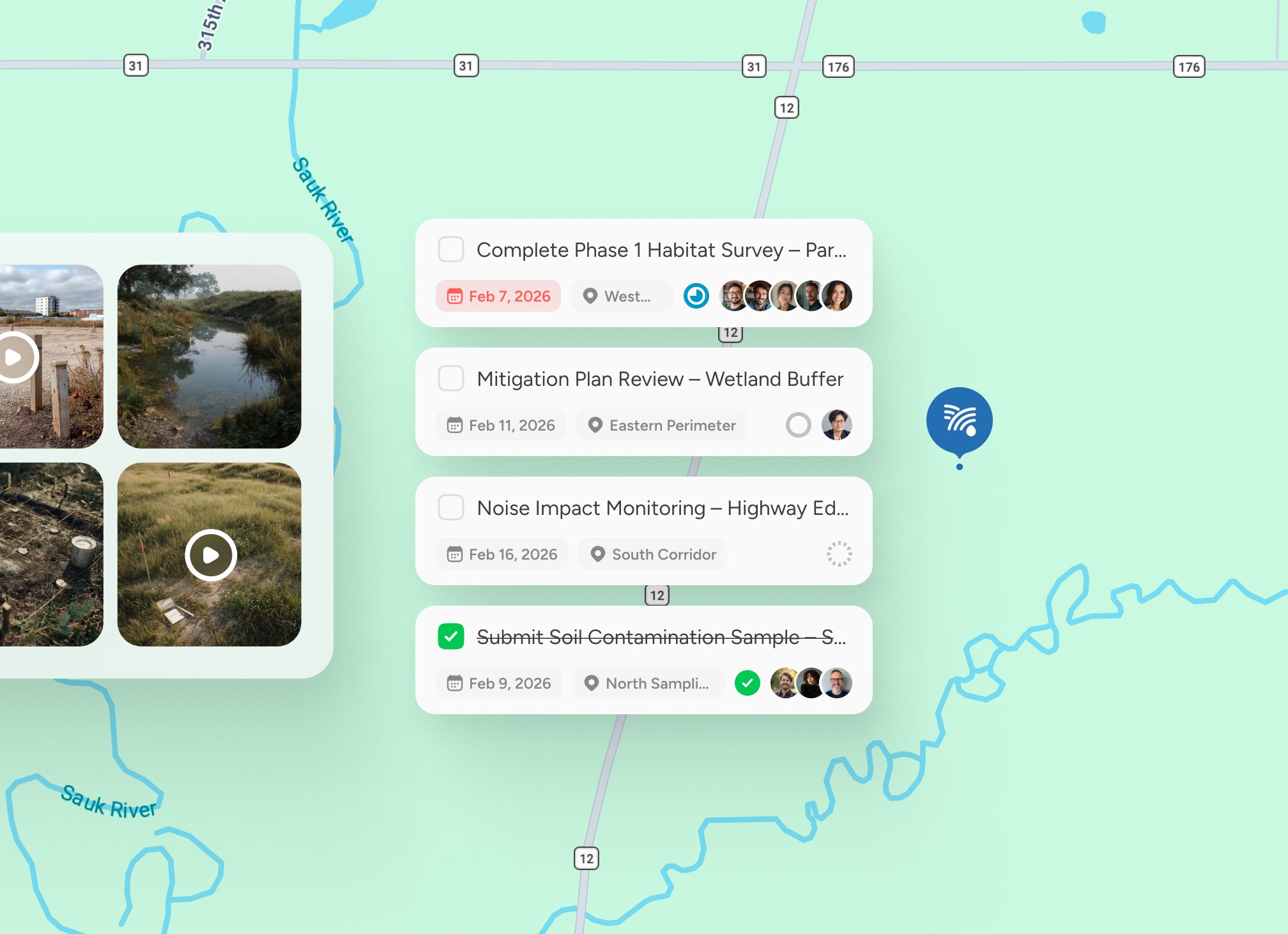
A countryside charity managing 14 reserves across the Norfolk and Suffolk coast surveys reedbed condition, breeding bird transects and ditch water levels on a recurring calendar. Pin Drop holds each transect, each fixed-point photograph and each water-level dip-well as a pin against the reserve polygon.

Observations that survive the data return
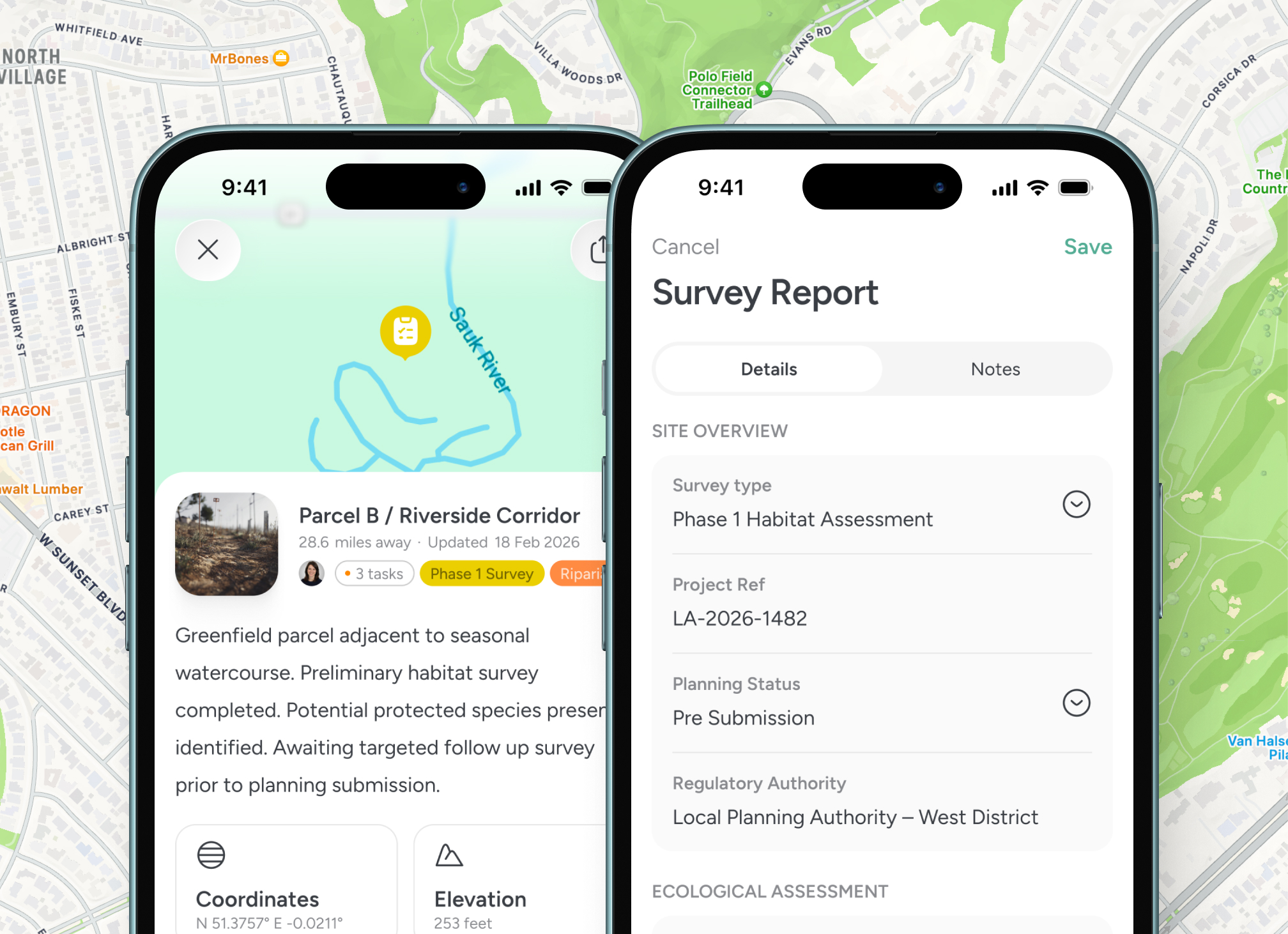
An ecologist on a great crested newt eDNA round records each pond, the sample timestamp, the water temperature and the kit batch number. The pin is the data return. The mobile app works offline at the back of a wet field with no signal, and syncs the photographs when the van gets back to the hardstanding.

Coordinate teams across a landscape, not a building
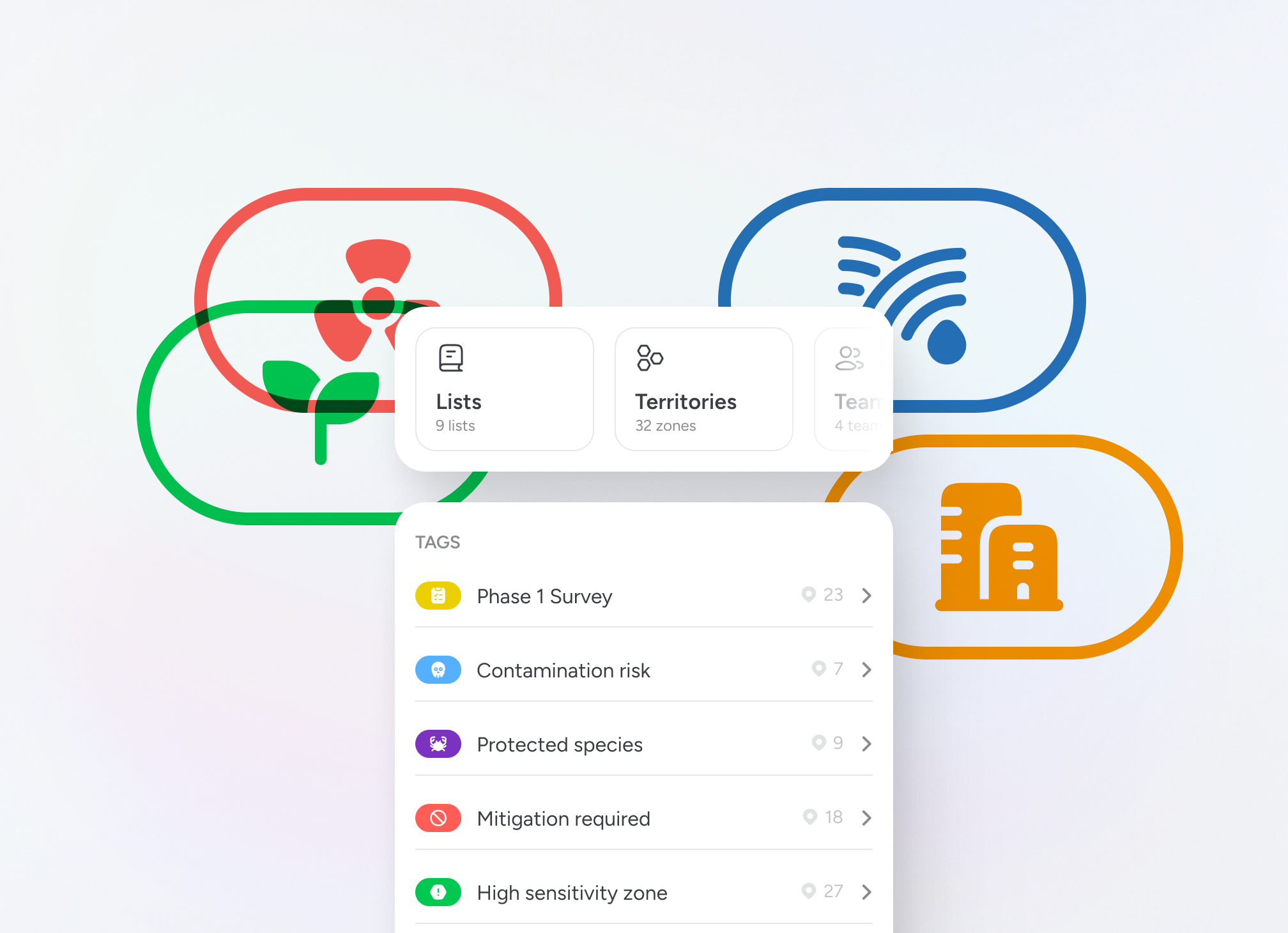
Conservation work covers landscapes, not addresses. Territories drawn around a catchment, a SSSI or a Nature Improvement Area mean each surveyor opens the app to a map of their patch with the protected species records, the licence conditions and the visit calendar already loaded.

A data trail that satisfies a Natural England audit
Protected species licence work under European Protected Species and Wildlife and Countryside Act 1981 schedules has reporting obligations that depend on the time, place and method of every observation. Pinning the survey to the polygon, with the licence reference and the surveyor's competency, produces the trail by accident rather than by effort. Rated 4.7 out of 5 from over 1,400 reviews.
BNG baselines and UKHab condition assessments
Built for the way ecological survey actually works

From the BNG baseline to the year-five monitoring report
Biodiversity Net Gain has changed the shape of survey work. A development site needing a 10% net gain calculation under the statutory metric is, in field terms, a UKHab condition assessment that has to be repeated at year one, year two, year five and year ten. Pin Drop holds the baseline as habitat polygons with condition scores, drops fixed-point photographs at the corners, and surfaces the next monitoring visit when the calendar comes round. The same workspace handles the recurring nature reserve work that does not have a development trigger, like a Phase 1 habitat survey across a country park, a hedgerow regulations assessment in advance of a fence-line repair, or a wintering wader count at high tide on a coastal reserve. The ecologist arriving at the gate opens the previous survey on the mobile app and walks the same transect, with the polygons, the historic counts and the licence conditions in front of them. Pin Drop is rated 4.7 out of 5 from over 1,400 reviews.

Testimonials
Trusted by UK ecologists, NGOs and conservation teams
Used by environmental consultancies running BNG surveys, conservation charities managing reserves and statutory bodies coordinating species recovery work. Rated 4.7 out of 5 from over 1,400 reviews.


“Notes, locations and progress stay together, which makes reporting much more reliable later on.”

Priya
Environmental Survey Lead
“Having a clear, location-based record has strengthened our oversight across multiple conservation sites.”
Maya Shaw
Habitat Monitoring Coordinator
“We can see which areas have been covered and plan the next round of surveys without guesswork.”
Jonas Krul
Environmental Field Lead
Guided walkthrough
See ecological survey on a shared map
Walk through how an ecologist plans a week of UKHab assessments, walks a transect with the previous count loaded and closes the day with a defensible BNG baseline already on the map.


