Agriculture & Land Services
The shared map UK farms and estates run their land from
Farm managers, estate teams and contractors use Pin Drop to plot every parcel, log every inspection against its boundary and run seasonal jobs across the holding without rebuilding the plan from scratch.


BEST OF 2013
Rated 4.7/5


FEATURED APP

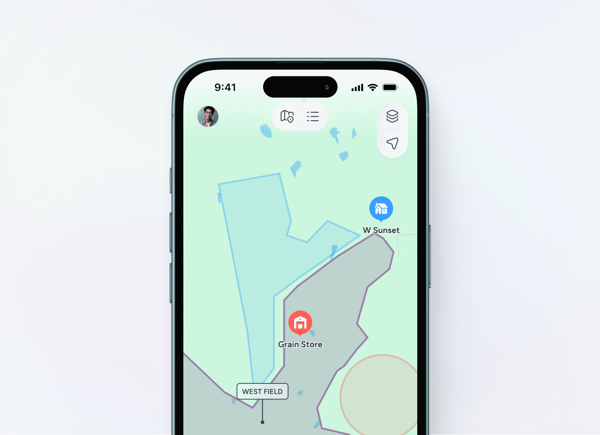
Parcels, not paddocks scrawled on a map
A 1,200-hectare mixed estate in the Cotswolds has parcels under arable, parcels in countryside stewardship and parcels rented to a neighbouring grazier. Pin Drop holds each one as a polygon with the BPS field number, the SFI agreement code, the cropping plan and the inspection history attached.

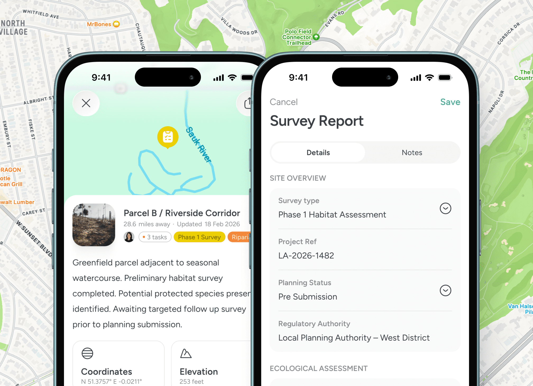
Walk the field, log the field
A weed strike in the wheat. A blocked culvert on the bridleway. A breach in the boundary fence above the river. The estate worker drops a pin with photos in the spot where they saw it, and the office sees the same pin within seconds.

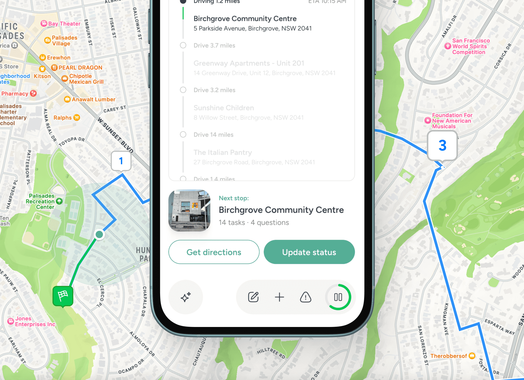
Contractors and machinery you can actually find
When the spraying contractor turns up at 06.00 on a humid Thursday, the foreman opens the map, sees the three parcels due treatment, the nearest fill point and the access gate, and sends the route to the contractor's phone before the kit is unloaded.

A record that holds up to a Red Tractor or RPA visit
Inspections, treatments and field events sit on the parcel they happened on. When Red Tractor or the Rural Payments Agency walks the farm, the audit trail is the map. Rated 4.7 out of 5 from over 1,400 reviews.
A typical autumn week, mapped
From drilling to harvest, the holding stays in one workspace

Seasonal fieldwork in plain view
An autumn week on a UK arable farm tells the story. Monday morning, the farm manager opens the map and reviews the parcels drilled on Friday and Saturday, marking each one with the variety and the seed rate. Tuesday, a sprayer goes out across six parcels with a pre-emergent. The application drops as a pin against each polygon, with the product, the dose and the wind reading. Wednesday, a stewardship inspection is planned for the buffer strips along the watercourse, and the map already shows the SFI code and the last walk. Thursday afternoon, the agronomist scouts the early-drilled fields for slug damage and pins the hot spots. Friday, the manager runs a five-minute review with the operations team standing around the same map on a tablet, and Saturday's plan goes out by 17.00. There is no spreadsheet to reconcile because the spreadsheet was the map. Pin Drop is rated 4.7 out of 5 from over 1,400 reviews.

Testimonials
Trusted by UK farms, estates and land services
Used by mixed arable farms, large estates, contract farming businesses and land service firms working across the British countryside. Rated 4.7 out of 5 from over 1,400 reviews.


“Operational zones and field tasks are measurable across seasons.”

David Mwangi
Regional Farm Supervisor
“Mapping fields and seasonal activity improved how we plan across large areas of land.”
Lucas Fernández
Farm Operations Manager
“Apiary zones are now organised across properties in one operational view.”
Amina Farah
Agricultural Land Coordinator
Guided walkthrough
See farm operations on a shared map
Walk through how a farm manager opens the holding on a Monday morning, reviews last week's drilling, plans the week's spraying and walks the result with the team without leaving the map.


